This was my third attempt to climb a mountain in the Philippines with the same set of friends. We planned for a day hike to Pico de Loro (actually Mt. Palay-Palay) this time around! After Mount Pulag and Mt. Batulao, the burning question as to whose crazy idea was this still lingers with every step. I initially thought we were going to Pico de Loro Country Club Hamilo Cove so I said yes. But then I was shy to take back my word and forgot about the details of the previous climb. Haha. Yes, I can laugh about it now. During D-day though, this was what happened...
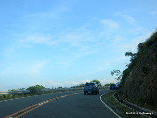
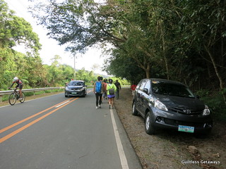
We took the Nasugbu route and past Pico de Loro (the beach club) to go all the way to the Pico jump-off point. We came from Tagaytay since the day before and not Manila. You just drive straight to Nasugbu then drive further and go through winding roads.
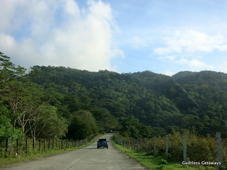

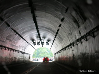
From the Kaybiang Tunnel (Ternate-Nasugbu Highway), you can already prepare yourself coz the adventure is close.


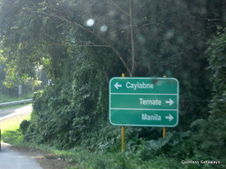
You turn right to Ternate when you see a fork with this sign before it.
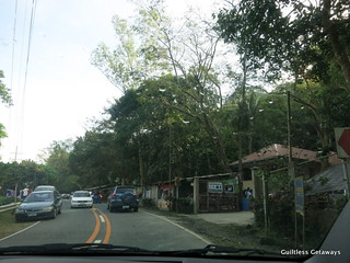
At our speed, we arrived in 10 minutes to this site.
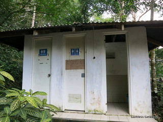
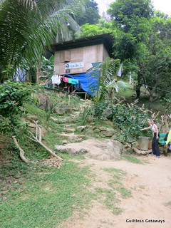
Being a gal, I find it important to know where the nearest and only bathrooms are. So yeah, there's one here and it will cost you P5 per time so bring coins. There's also a shower area but tabo type I think (didn't attempt).
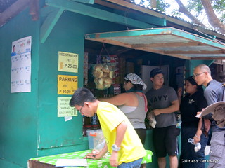
We also parked at this compound at P50 per car.
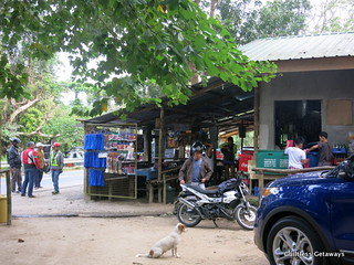
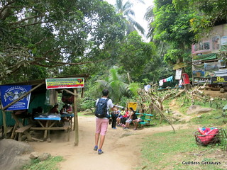
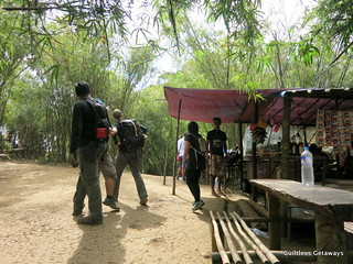
There's no briefing unlike Pulag (or maybe the place just wasn't as organized and we didn't know). Then there's a registration fee of P25 per person. We also bargained for a young local guide here. Not so worth it I think for his services (around P100 per person so he charged us ~P1000). Look for an older guide and referrals.
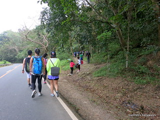
From the exit, we turned right and started walking.
No more than 10 minutes later, we were there.
9:24 a.m. Our young guide stayed in front and didn't really talk.
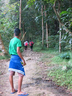
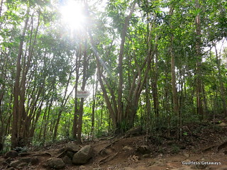
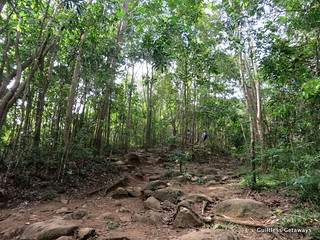
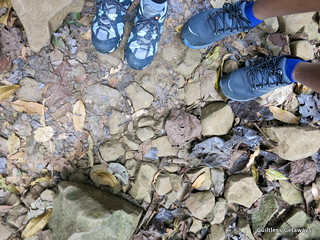
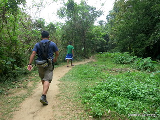
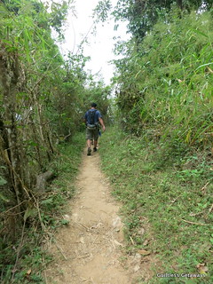
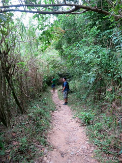
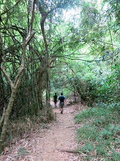
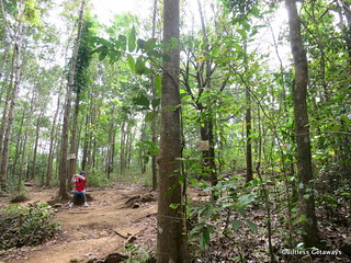
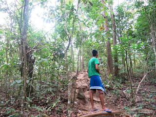
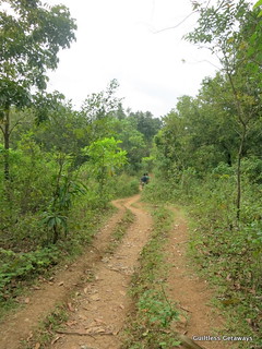
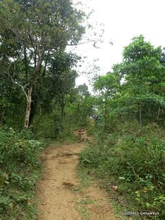
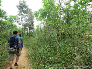
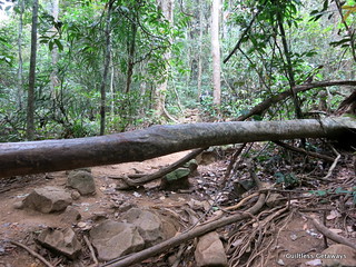
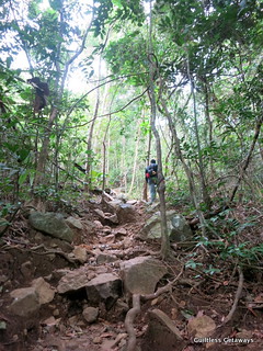
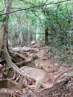
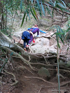
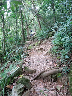
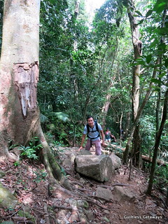
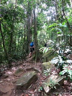
Here are the various kinds of walkway in the trails by order.

Plenty of loose rocks.

9:38 a.m. When we saw this sign, we turned right.
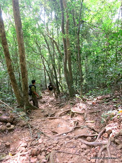
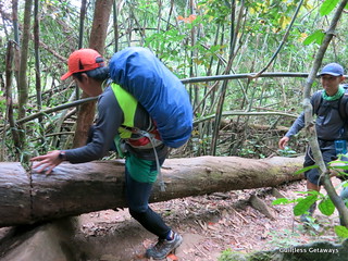
The walk was up and down.
Better to wear comfy footwear.
The trail started descending and I was beginning to feel that I didn't train well enough. Again.
J and I were lagging behind haha. I was being careful and slow (pacing myself and having an internal battle to go back) and we were just 30 minutes into the trek.
10:09 a.m. 5 minutes more and we got to a pitstop. There's a comfort room here for P10 with just a cover (but you have to go up a flight of stairs) and another registration fee P25. Something about this trail being bordered by Batangas and Cavite so you paid the other one a while ago and you pay a different one now.
10:17 a.m. I tried to go in front to quicken my pace. My new friend mountaineer enthusiast Yano said that at flat areas, I can speed up to catch the others.
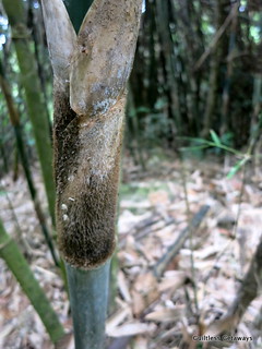
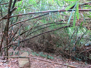
I can but I guess I unconsciously refuse to. I was having too much fun just walking at my own pace, documenting, discovering and observing things like this prickly and hairy part of the bamboo plant you shouldn't touch unless you want splinters or if you brought enough duct tape.
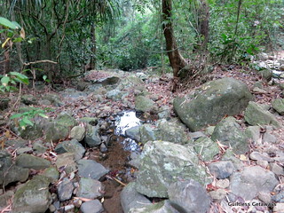
Within 10 minutes, we reached a place with water. I won't drink here though and there's no recommended potable water source for the trip.
Not before long, I let my mates pass me. I don't like to race and I felt like passing out if I keep up with their pace.
I was going to finish this but at my own pace. I believe this is the point where you go left for the waterfalls or straight to camp.
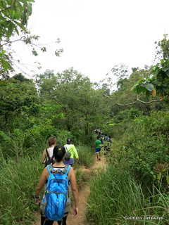
10:42 a.m. As you can see, the path is not as flat as I want it to be.
Our other mountaineer mate Mik wanted us to be prepared with at least 2L to 4L of water but I didn't want the weight and to keep on peeing so I was not in a good state and I was also not in good shape.

There were a lot of places with both shade and none so the heat was also variable at different points in the trek.
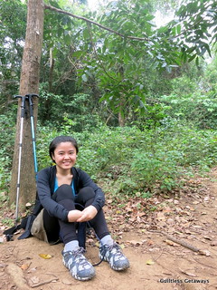
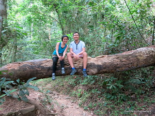
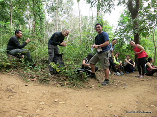
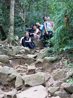
10:48 a.m. We took around a 10-minute break at this place because the road started getting more vertically challenging already. I seriously needed to sit down to prepare myself. There's Allan, Mik and Yano =) Thank you so much for going with us!
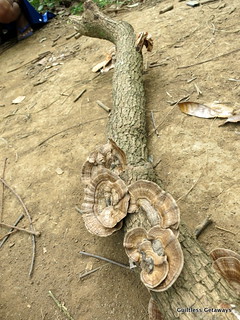
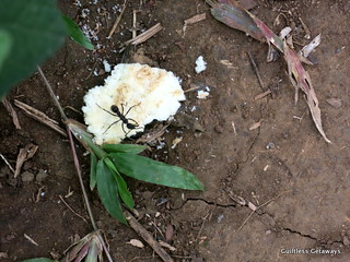
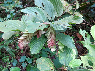
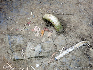
I took the time to observe some plants and insects too.
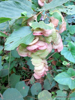
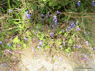
These purple ones in particular are a nice sight when I felt like giving up.
I was with Yano and Mik and we started talking about how to survive in the jungle. They said that some type of vines have water in them. I later read that these baging (vines, not necessarily the ones that have water so don't cut!) are special to this mountain.
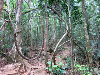
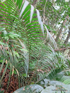
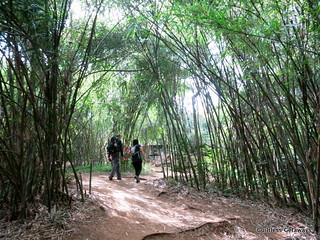
These are the sights that made this mountain memorable for me: the nature walk, the vines, the flowers, the bamboo and many more. It kept me sane, especially when the route turned into a challenging assault.
11:25 a.m. I don't like people waiting for me though and dragging the group slower. It was definitely not a walk in the park both physically and emotionally.
I wouldn't change the way I trekked though. I tried to look down as much as possible for roots, loose rocks and vines,
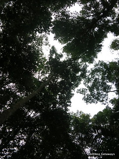
to look up to hear the birds, notice the blue sky and appreciate the shade
and to look around me to avoid getting cut and splinters from bamboos and trees like these. They are very abundant in this area.
Hingal to the max at some points.
Effort to the nth level and holding on tight at other points. Gloves are a good idea for me.
Look to the left and right at some points (sometimes bangin).
I looked back and even J was along my pace haha.
There were moments when I felt lost when I can't see the person in front of me anymore because there were not much arrows (but there are markers in the trees sometimes).
12:09 p.m. One last hurdle and we're almost to camp.
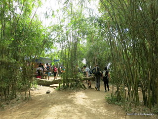
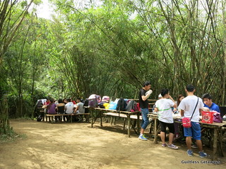
12:29 p.m. When I saw this, I figured bamboo has got to be one of the charms of the Pico de Loro trek. It also signalled that we were at camp already!
There's a free restroom with a cover near this store and water if you run out.
Tents are pitched in this area and they have limited tables for lunch (bring your own though so that you are covered).
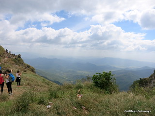
There's an open area with a view and without shade.

From here, I didn't think the trek to the monolith would be that bad (but never ever assume the best...) and I think it deserves another post haha.
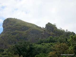
Lovely view, eh? Maybe an overnight trip would be very fun for some of you. The route we took I think was the old one because somebody pointed out another "new" route to us on the way down so you may want to ask around more.